Driving the Troncal Amazonica into Ecuador’s Amazon

We want to encourage you to leave the Panamerican Highway and explore the Amazon region of Ecuador. We drove part of the “Troncal Amazonica”.
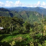
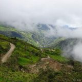
The “Troncal Amazonica” for us was the long way around to Cuenca, coming from the Corpus Christi festival in Pujilí . We chose this route because we had travelled the Pan-American Highway before. First we drove from Riobamba to Macas. This road passes through the World Heritage listed Sangay National Park. As you would expect, the scenery was quite breathtaking. It included forested mountains, lakes, and curious local houses with thatched roofs, held down by woven ropes.

We came past the Laguna Atillo in the Sangay National Park.

Apparently these grass covered roofs, held down with ropes woven from the same grass, are very typical for the eastern highlands of Ecuador.

Quite a few towns in Ecuador have public art made from hand-painted tiles. This wall is in Macas.

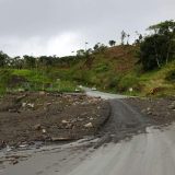
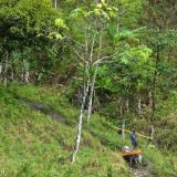
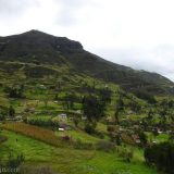
Here you can see the impact of a single small farm inside the dense forest of the Sangay National Park.

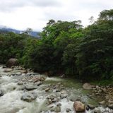
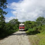
Our free camping spot by the river outside Macas.
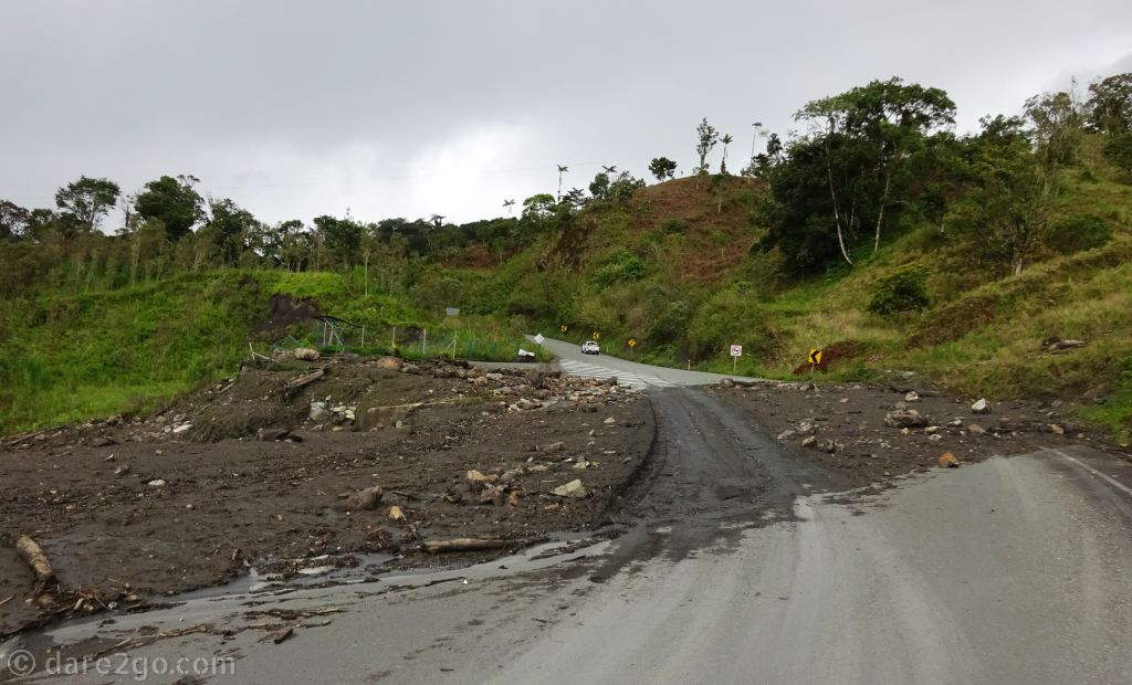
From Macas to Gualaquiza, we followed the Troncal Amazonica – E45. This is the most easterly main road and runs almost the length of the country. It gave us a taste of the Amazon basin region of Ecuador. There was a lot of water damage and landslides once again; in one place a signposted mirador was completely missing – it had slid down the hill.
Please click thumbnails below for a larger photo with description.
-
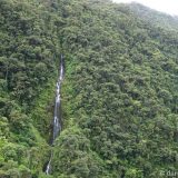
- One of the countless waterfalls we saw along the Troncal Amazonica.

-
- One of the many rivers we had to cross (on bridges) along the Troncal Amazonica.

-
- The space on the left used to be a ‘mirador’ (lookout point), but it was all washed away by a flooding river.
-
- Driving through the Amazon region of Ecuador: green as far as the eye can see.

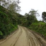
We left the E45 at Gualaquiza and turned towards Cuenca via Sigsig. Initially the GPS took us on the wrong road. It was very narrow, but also scenic; lots of tropical vegetation and beautiful flowers.
Finally we hit tar, and realised that we could have been driving it since just south of Gualaquiza. Oh well, we do like to drive the roads less-travelled.

Beautiful orchids were growing right next to the road, poking their flowers into our way.
Please click thumbnails below for a larger photo with description.
-
- Well, we shouldn’t have taken the old road (don’t trust your GPS). It was just too narrow in parts, but the scenery was quite beautiful.

-
- …and then the road became just a bit narrower.

-
- Small scale logging: this guy brought a few pre-cut beams down from the forest, tied to the back of his donkey.

-
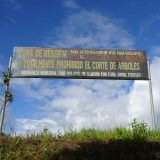
- At least the authorities begin to restrict logging. This sign warns about a fine of US$500 per illegally felled tree. That’s more than Ecuador’s minimum monthly wage!

-
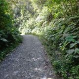
- The road winding uphill from Gualaquiza through the cloud forest.

-
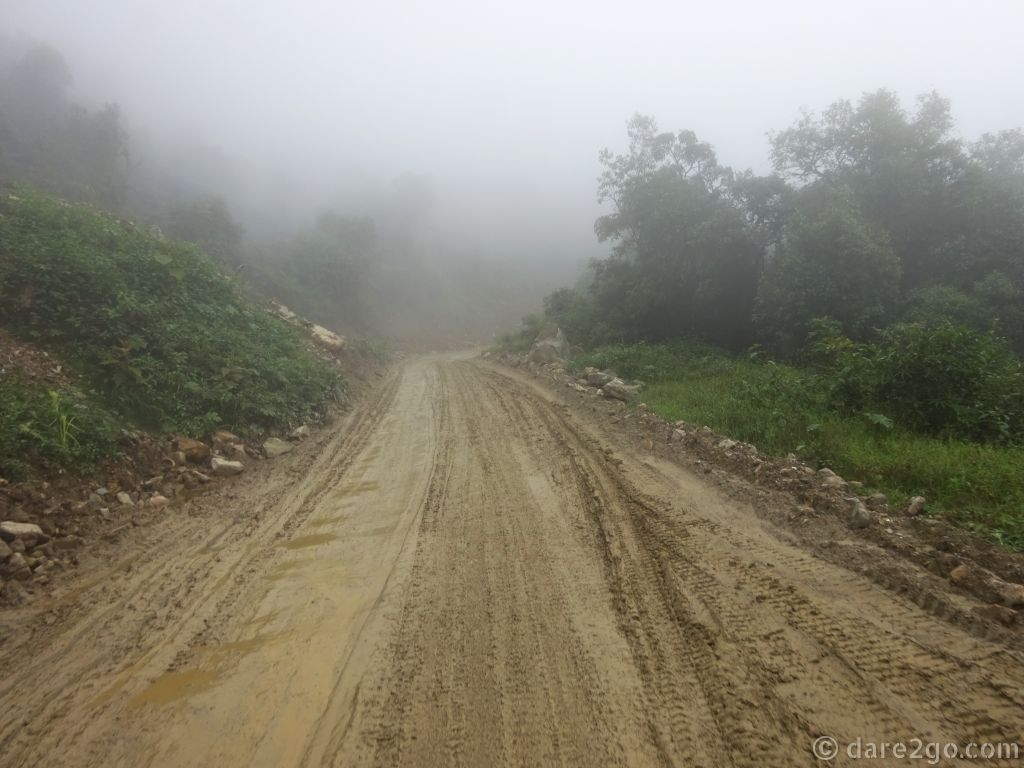
- I was glad that we had to drive uphill here, as this muddy surface was really slippery. In 4×4 we had enough traction to make it.

-
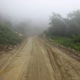
- The visibility became worse the higher we climbed and the road became much wetter.
-
- At the end of our drive through the Amazon we arrived at Sigsig, a town we had visited before in 2008.


Part of the scenery along the old road out of Gualaquiza
Unfortunately once we found the tar we also found road works, which continued on and off until we had almost reached Sigsig. Some of it was smooth driving, but other parts were almost impassable mud. As if that wasn’t bad enough, we then hit fog! It was an adventure.
Currently we don’t recommend the drive from Gualaquiza to Sigsig if you don’t have a high clearance vehicle! You could do it carefully and slowly with a normal car, but not in a low camper van with vulnerable tanks or other installations below the floor. The road south towards Loja is okay.
We had hoped to continue the Amazon exploration further north, after obtaining our visa extension… We have numerous recommendations from locals about places we should have visited. Sadly we didn’t have enough time left to follow up on these, but we would have loved to go.
We would have taken the Ruta 20 east from Quito to Baeza and Coca, from where one can drive a loop through the northern Amazon region of Ecuador. Along this route you can visit several ecological reserves.

Map of the north Amazon in Ecuador. This shows the route from Quito to Limoncocha (on the far right).

The lagoon at Limoncocha is best explored by boat [image credit]
The “Limoncocha National Biological Reserve” is protected land along the Napo river. It was highly recommended to us as a place teeming with wildlife. People also told us that you can see the famous pink dolphins there. For the best wildlife experience you need to take a canoe trip. Apparently the local indigenous community is very welcoming to overlanders.

Two tropical birds, called Hoatzins, photographed in the Limoncocha Nature Reserve [image credit]

A pink dolphin, which can be only found in the Amazon river and its tributaries [image credit]
In the north you find the “Isla de Los Monos” , a sanctuary for monkeys and other wildlife, displaced from their habitat by human interference, or even traumatised in captivity. Several people had recommended a visit as an uplifting experience.

The landscape near Yantzaza in the Amazon region of Ecuador [image credit]
Have you been to any of the places mentioned in this post?
Or would you like to add another recommendation for a place to visit in the Amazon region of Ecuador?
Please tell us in the comments below.

Like this? PIN this!
![The Industrial Revolution is an important part of the heritage of Wales. As diverse as they are, each site has a unique and often fascinating story to tell. [Photo shows the water balance tower of the Blaenavon Ironworks.]](https://dare2go.com/travel/wp-content/uploads/2018/12/Industrial-Heritage-Wales-featured-520x245.jpg)