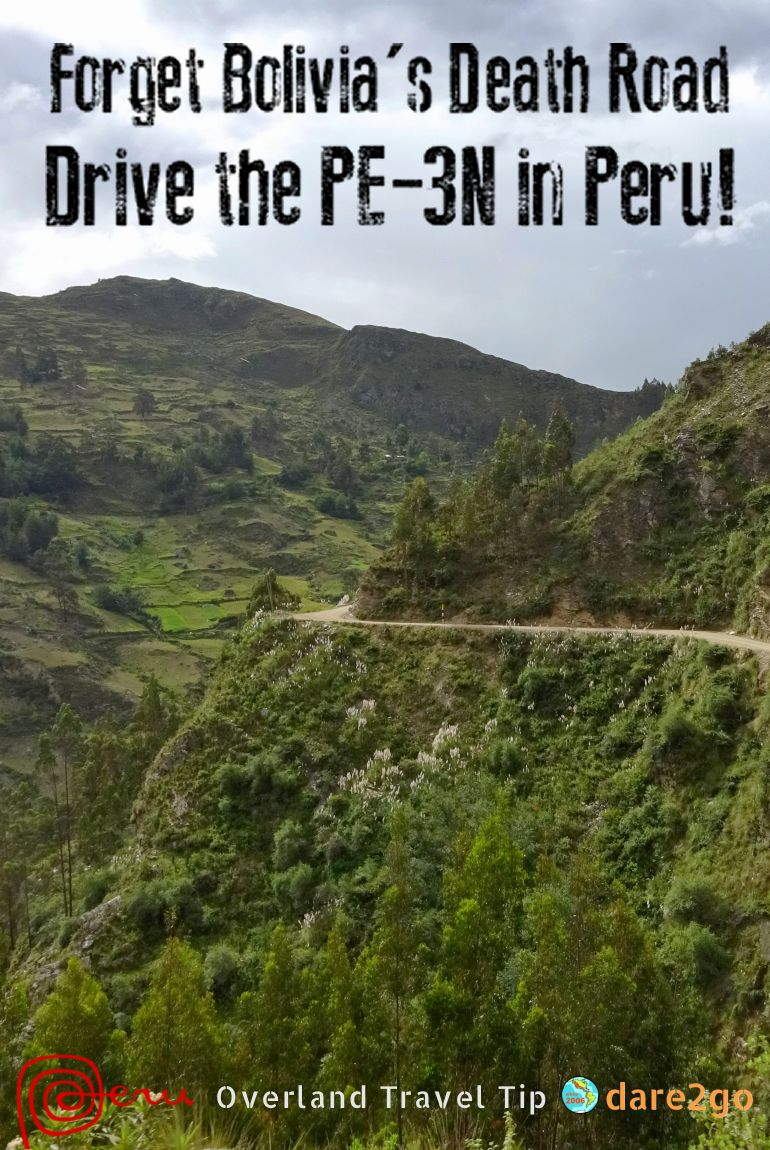
Forget Bolivia’s Death Road – Drive the PE-3N in Peru!
Our headline might sound sensationalist, but did you know that the oh-so famous ‘Death Road’ in Bolivia has been reduced to a tourist attraction? There’s a newly built road in place which takes all non-tourist traffic. As a result, the old road is now mostly used by organised bicycle and motorbike tours. On top of it you now pay an entrance fee for the thrill. Its reputation came from the fact that it used to be a busy two-way road and, in many places, was too narrow for trucks or buses to pass each other…
To have the real nerve-wracking experience of regular traffic on a road that is too narrow, with plenty switch-backs, steep drops, landslides, broken-off edges, and crazy drivers, you should drive the PE-3N from Huaraz to Huánuco in Peru. Seriously!
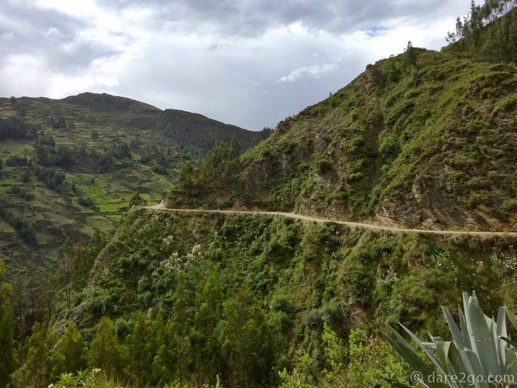
This was by no means the steepest drop along the PE-3N. The region is actually fairly densely forested, mostly with Eucalypt, so often Yasha couldn’t photograph for all the trees…
We actually didn’t expect it to be quite that bad. Yet, in hindsight, we’re happy that it’s over and that we made it – without an accident. When we arrived in Huánuco on Friday afternoon, all I was only capable of opening a beer and lying flat on the bed…
From its number, PE-3 (the N stands for ‘north’), this should be one of Peru’s main highways. If you look on the map you can see that it is; it runs almost the full length of the country from north to south, inland through the mountains. Yet most commercial traffic feeds from the mountains down to the Panamerican Highway, Peru’s main road along the coast. The PE-3 seems to have become a ‘forgotten’ secondary road, of lesser importance.
Actually, we have experienced the PE-3 once before, but it hadn’t really connected in our minds. We drove part of the PE-3S on our way from Ayacucho to Huancayo . This was also a very narrow road, single lane in some sections, but at least the majority of it was sealed – albeit with big potholes. That drive felt much easier because a) we were driving with mountains always on our side, b) the drops weren’t anywhere near as scary, c) it was at least wide enough for semi-trailers to crawl along, and d) the region wasn’t as densely populated and therefore had much less traffic.
Okay, let me get to the PE-3N. We met up with this road coming from Barranca at the coast. At first we had to get into the mountains driving up the PE-16, which had been closed for several days due to heavy flood damage. On the way up we had to skirt some fresh landslides – but nothing major. It’s in Conococha where you meet up with the PE-3N. At that point, it comes down from the north (via Huaraz) and veers inland.
It’s 244 kilometres from Conococha to Huanuco, of which the first 70 kilometres are actually really good road. You go over one pass of roughly 4,700 metres (Abra Yanashalla) with a really unique looking extinct volcano behind it. Ten kilometres later the nice, smooth road continues to the left (as PE-111) and you have to take the fork to the right.
Well, we had read that some people complained about this section of PE-3N. Yes, it was narrow, with no room for a centre line. But, apart from some deep potholes, it didn’t look too bad. Early that afternoon we came past a deserted quarry and decided to stay for the night. It was a few kilometres before La Unión – from there onwards our GPS shows a road of lower standard.
Day 1: we had driven 115km, 70 of which were on the PE-3N, and stopped early.
Please click thumbnails below for a larger photo with description.


Apart from the fact that the road through the town of La Unión was in a terrible state, the next day we couldn’t see that much difference – at first. There was still asphalt, but the number of potholes increased gradually – until there were more holes than asphalt. But, according to our GPS map, this was only meant to last until Tingo Chico – some 30 kilometres.
In reality, from Tingo Chico onward the road got worse, much worse. We were going slowly uphill and had reached nearly 3,500m, with no place to pull off the narrow road. So we decided to drive into the town of Chavinillo, and stayed overnight right at their small square – the only flat bit we could find.
It was mid-afternoon. This region isn’t used to tourists, and thus we attracted quite a crowd. First only kids, later also some adults who asked us questions.
Day 2: we had driven 71km, took a longer lunch break, and averaged 20 kilometres per hour.
Please click thumbnails below for a larger photo with description.


It probably rained all night. At least, every time I woke up I heard rain. The next morning, after a slow start (we don’t sleep that well at altitude), we came back to a mostly muddy and slippery PE-3N. The gravel road around Chavinillo was actually the best for the entire trip; recently graded and rolled, so there were hardly any deep holes. And luckily, we were driving uphill; I find it less safe to drive downhill in slippery conditions.
We were approaching our last mountain pass on this route, Corona Del Inca (the Inca Crown) at 4,000 metres. Soon after, we were held up by our first roadworks for the day. In many sections the road is in such bad condition that it needs ongoing repairs. Most landslides are only roughly cleared away by some heavy machinery, leaving deep tyre grooves and unsafe edges behind.
We hit another road block some 20 kilometres before reaching Huánuco. Here some arrogant, rich Peruvian guy decided to pass the line of waiting cars and argue with the flagman that he should be let through immediately. He not only attracted strong opposition from all waiting drivers, in the end he caused some real chaos because uphill traffic was allowed to get through first – and he was blocking their way.
Peruvian drivers: the use of the horn replaces the brain and the brakes.
The behaviour of this driver seems to be indicative of Peruvian drivers in general. We have found everywhere, that they simply don’t seem to possess any road sense, and are the most aggressive and inconsiderate drivers anywhere in South America. This is most likely because private cars are still a bit of a novelty. When we travelled here in 2008, we hardly saw any private vehicles in rural regions, or even driveways going to houses. Today, you still come past villages, on the other side of rivers, which only have foot bridge access.
Most ‘hairy situations’ we experienced along the PE-3N were caused by people not driving to conditions, trying to squeeze through where there wasn’t any room to squeeze through, or coming around blind corners at high speed.
Day 3: we had driven 70km, were held up at 2 road works, and our average speed was 10km/h
Please click thumbnails below for a larger photo with description.


Almost all photos on this page were taken by Yasha with her new point-and-shoot Sony camera (Amazon Link). I was too busy driving… We don’t have any pictures of really frightening situations because, by her own confession, Yasha often simply closed her eyes. She opened them more often than felt comfortable to shoot out the side window – trying to ignore the sometimes very steep drop next to her.
We also don’t have a single photo of our truck Berta on this road; there was always too much traffic to think about stopping.
For Peru, to get the PE-3 up to the standard of a modern road, capable of taking the increased traffic of this century, will most likely take years. Any widening of the existing road would require extensive blasting and earth works. All of the Andean mountains seem to be very unstable. Any serious rain causes immediate landslides. Now (March 2017) the country has just experienced a serious set-back: the entire Panamerican Highway north of Lima has been damaged by recent floods, with bridges washed away and four lanes often reduced to less than half a lane.
So don’t expect that the condition of the PE-3 will change much in the foreseeable future.
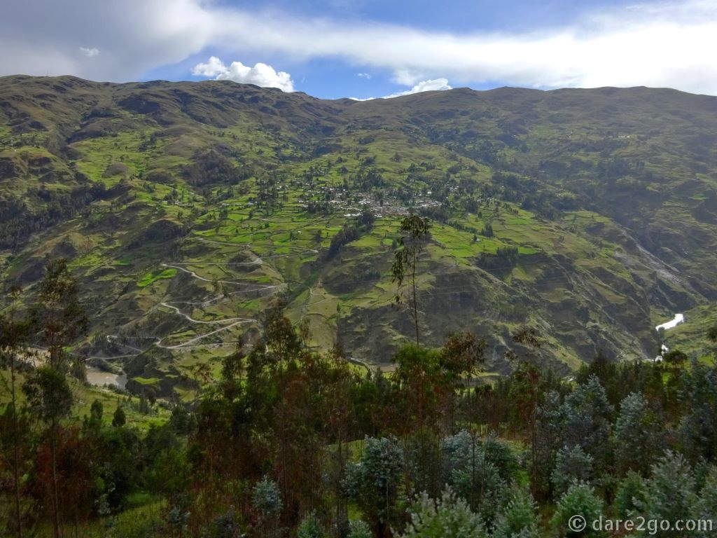
A vista across the river to Chavinillo. Notice the road winding up from the river. It’s not the one we took.
Postscript from Yasha: although Juergen couldn’t really take his eyes off the road to see it, there is some stunning scenery along this road. In between holding my breath and shutting my eyes, I really enjoyed the vistas that the amazing Andes can surprise me with, time and again. I never get tired of being in the mountains.
[All photos shown in the galleries are in time order.]
Since I wrote this post and decided on it’s title, we have driven another road in Peru, which was somewhat more scary . From Chachapoyas to Cajamarca there is only one route to take. It winds its way twice to up over 3,600 metres, dropping in between to as low as ~800m.
The conditions are quite different. The PE-8B, described in our newer post [link above], is almost completely sealed. This provides more control over your vehicle because there isn’t a lot of slippery surface. But most of it is much narrower than the section of the PE-3N, which is the topic of this post. In many places it was really so narrow that my wheels were touching both road edges at the same time. And the drops next to the road are much steeper! There are the occasional guardrails, but I would never trust them to stop a heavy vehicle from going over the edge. And anyway: they are few and far between…
PIN THIS for later!
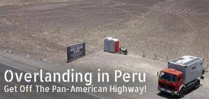
![Driving the Pan-American Highway – a dream of many. Our post summarises all the basic practical information you need to know before overlanding in Peru. [Photo: overland truck parked at the Nasca lines in Peru]](https://dare2go.com/travel/wp-content/uploads/2020/07/Overlanding-Peru-featured-1-520x245.jpg)

![The mainland coast of Greece has many picturesque towns you should visit by car or motorhome. These towns are cheaper to reach than the famous Greek islands. [Photo is of a sunset behind a large sailing boat in Plataria.]](https://dare2go.com/travel/wp-content/uploads/2020/07/west-greece-featured-520x245.jpg)


I have been living in Cuenca, Ecuador for ten years since retirement. I have traveled a bit on both sides of the mountains and agree that the mentality of drivers is bizarre. It is not confined to the campos, the cities are worse. I am planning to drive to Machu Picchu and don’t care for the coast. So I was researching Hwy 3 & 5 and it gets confusing to get from 5 to 3 to continue South. I’m 72 and it will be next June/July (2023) when I travel, alone with a dog. I am well traveled in the USA, did four corners on a motorcycle, along with many other trips so I’m no rookie, but I’m not a young man anymore. Am I crazy?
Sorry for my late reply, Leonard! No, you’re not crazy and I can understand why you don’t want to drive the coastal route. We didn’t like it either…
You realise that June/July is winter in Peru and it can get very cold, particularly in the mountains over night? The No.3 inland route is in places well over 3000 metres (or about 10,000 feet). It was not a good road for most of its length in 2017, when we drove it, and I doubt that much has changed. It suffers from frequent landslips and most of it is not much wider than single lane. But the scenery is stunning and compensates for a lot!
The best part of the 3S is between Cusco and Ayacucho, where the tourist are. North from there we had to go searching for it because it wasn’t even signposted (and online maps unclear).
But on the other hand you don’t have many other alternatives if you want to stay off the coast road with all its heavy vehicle traffic.
I recommend that you use a rugged (and preferably old) vehicle with simple technology and good clearance. A couple of sections were unpaved after landslides. I also would suggest that you take your own sleeping bag as some accommodation along the way might be very basic. If you travel that way, one place I can honestly recommend for a few days is “Hospedaje Hacienda La Florida” near Tarma; a beautiful old hacienda with wonderful hosts (listen to their stories, they had been evicted by the Shining Path).
Here’s a small Facebook gallery of photos I took on the 3S north from Ayacucho.
Enjoy and don’t hesitate to ask more questions!
(We currently are tied down with our private home that was flood damaged and don’t get much to our website.)
Agreed!! Our running joke while driving the 3N, 8B and others was that the fact that Bolivia even bothers to call one of its road “The Death Road” must mean that it doesn’t have that many of them. In Peru, they just number each death road. :-)
LOL – not often that a comment makes me laugh out loud. Yours just did!
The latest I read is that the so-called ‘Death Road’ in Bolivia has been freshly graded and widened. I’ll wait to see any widening to happen on the PE-8B .